
Yearly Archives: 2026
18 posts
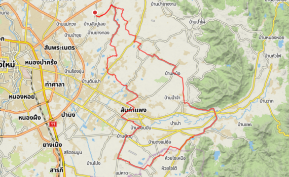
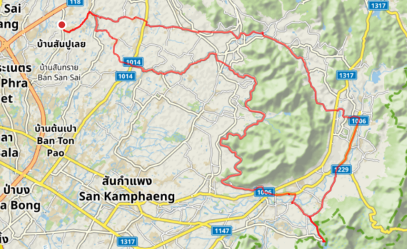
Distance: 74.69 km
Elevation Gain: 378 m
Coffee Stop: Naive Cafe
A slightly longer variation on the Crazy Horse loop. Start going east via Village Green and The Cave to the Mae On Valley. Loop around Crazy Horse area going south with then a detour to the Mae Pha Haen reservoir. Coffee stop near Naive Cafe and then via upper irrigation canal back north until back home.
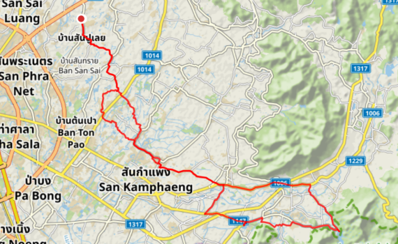
Distance: 60.75 km
Elevation Gain: 217 m
Coffee Stop: Need Cafe
A loop heading south out of Doi Saket, passing through San Kamphaeng towards the quiet backroads of Mae Pha Haen. The route is mostly flat except when approaching the Mae Pha Haen dam.

Distance: 58.99 km
Elevation Gain: 133 m
Coffee Stop: Phoo Na
A mostly flat loop around Doi Saket. Started with a southern loop below Route 118, stopping for a coffee break at Phoo Na Café. From there, headed north with a loop up toward the Mae Kuang Dam before heading back.
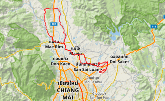
Distance: 90.73 km
Elevation Gain: 260 m
Coffee Stop: Rab-a-bit
A flat loop through the countryside north of Chiang Mai. The route goes northwest past Maejo University and up into Mae Rim. After making a loop with some gentle slopes across Route 107 in Mae Rim, it follows rural roads back down to finish where it started.
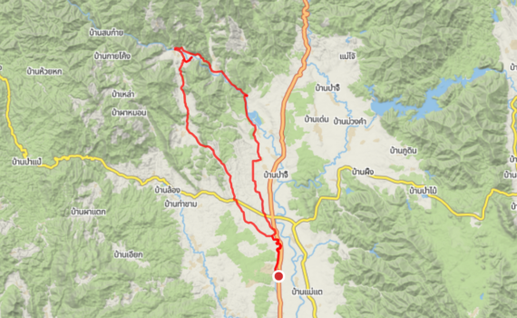
Distance: 65.51 km
Elevation Gain: 800 m
Coffee Stop: Secret Elephant Sanctuary
This ride in Mae Taeng starts from Route 107 and climbs up into the scenic valley where there are many elephant camps. A gravel road leads to a coffee stop at the Secret Elephant Sanctuary. After coffee, the route takes an alternative mountain road back toward the starting point. Both the beginning and end of this loop are a stretch of gravel road running parallel to the 107.
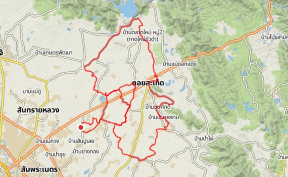
Distance: 63.65 km
Elevation Gain: 208 m
Coffee Stop: Innocent Cafe
This is a flat ride that starts with a loop south of Route 118, stopping for coffee at the Innocent Cafe. From the cafe, the route turns north heading up toward the Mae Kuang dams before turning back southwest to complete the loop home.
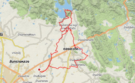
Distance: 50.99 km
Elevation Gain: 392 m
Coffee Stop: Magic Beans
This is a mainly flat ride that heads north first toward the Mae Kuang dams. After tackling the steep climb up to the main dam, we took the quiet little back road over to the second dam, lifting the bikes past the two barriers along the way. Then to Magic Beans for a coffee stop before heading south for a final loop past the Doi Saket lakes on the way back home.
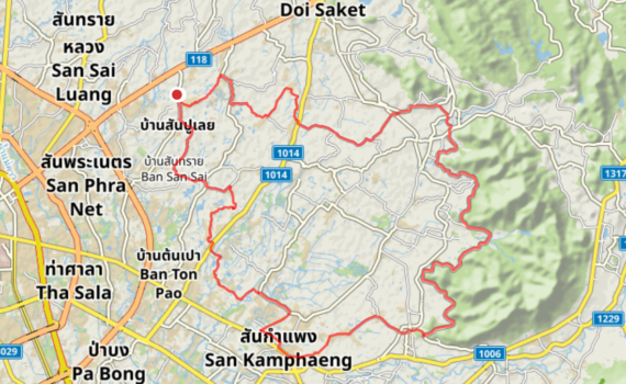
Distance: 60.53 km
Elevation Gain: 204 m
Coffee Stop: Life Happens Coffee
A flat ride heading southeast toward San Kamphaeng for a coffee stop at Life Happens. From there, the route follows the upper irrigation canal road heading north before looping back home.
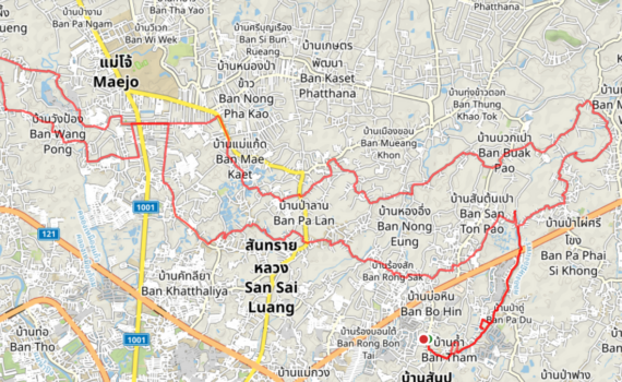
Distance: 61.01 km
Elevation Gain: 130 m
Coffee Stop: Hamoy Hamoy
A flat ride heading west into the lower Mae Rim area. The route crosses Route 1001 near the Maejo police station, loops through some quiet rural backroads, and makes a coffee stop at Hamoy Ha Moy. Then back a slightly different way to close the loop.
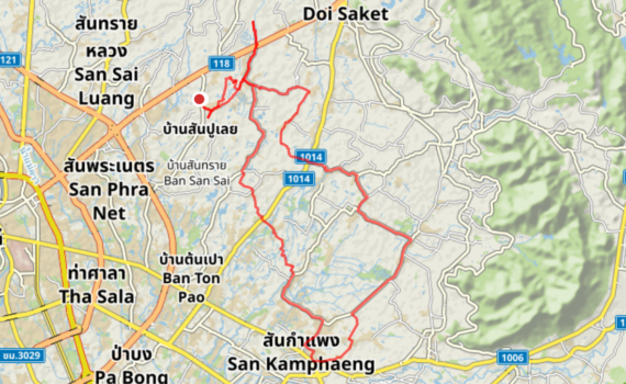
Distance: 50.34 km
Elevation Gain: 119 m
Coffee Stop: Natang Coffeehouse
A flat loop heading south toward San Kamphaeng with a coffee stop half-way at Natang Coffeehouse.
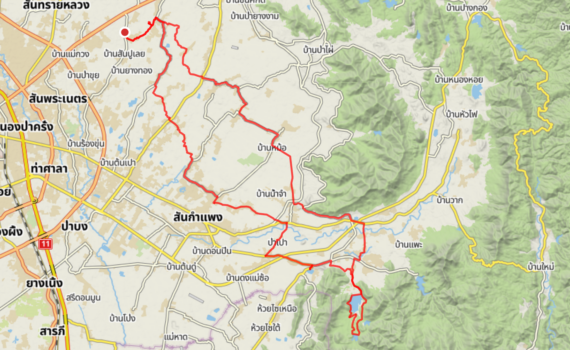
Distance: 68.56 km
Elevation Gain: 316 m
Coffee Stop: Need Cafe
This Huai Lan loop starts as a mostly flat ride heading southward. It involves some climbing and a stretch of gravel road near the Huai Lan Reservoir. After circling the reservoirs, the loop continues to Need Café for a coffee stop. After coffee, back up north to head home.
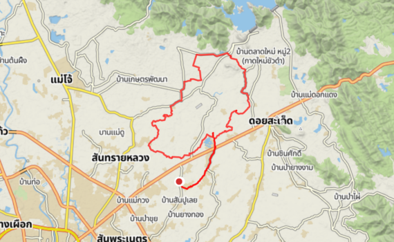
Distance: 38.75 km
Elevation Gain: 93 m
Coffee Stop: Rolls Space
This is a short, flat clockwise loop with a coffee stop at Rolls.space before completing the circle back home.

Distance: 56.43 km
Elevation Gain: 153 m
Coffee Stop: Village Green
This is a mostly flat loop that spends the first half of the ride in the countryside south of Route 118. The route then includes a coffee stop at Village Green before going north past the Doi Saket lakes. Then crossing back over the 118 to complete the loop home.
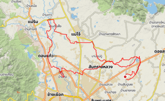
Distance: 64.19 km
Elevation Gain: 138 m
Coffee Stop: Coffee ? Opposite fire station
This is a flat ride through the Mae Rim area, with a loop along the west side of the Ping River. The route includes a coffee stop at a small local cafe located directly opposite the fire station, before crossing the river once more to head back home.
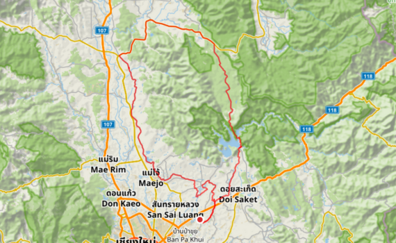
Distance: 106.01 km
Elevation Gain: 832 m
Coffee Stop: Treehouse
Our longest ride so far. First we headed north, going past the Mae Kuang suspension bridge and then immediately taking on two serious climbs. After these hills, we had a coffee stop at Treehouse, then continued to Route 1001 in Mae Taeng and finally back south through the Maejo area.

Distance: 58.07 km
Elevation Gain: 173 m
Coffee Stop: Yellow House
This route starts with a loop around Doi Saket, passing by the Doi Saket lakes. From there, we headed north toward the Mae Kuang dams for a coffee stop at the Yellow House. After coffee, we completed the ride with a loop to the west and then turned south to get back home.
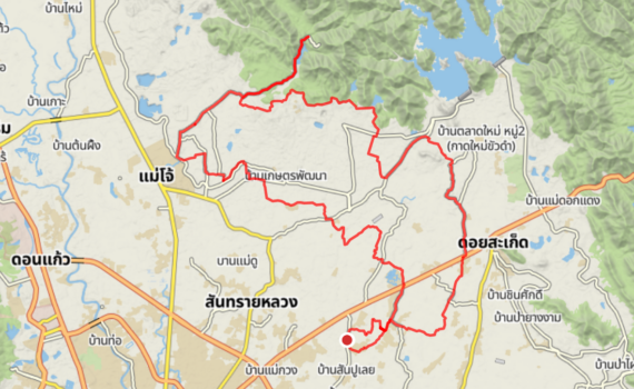
Distance: 63.86 km
Elevation Gain: 301 m
Coffee Stop: Owlet
This ride takes a northern route heading first toward the Mae Kuang dams, followed by a long, stretch of gravel road to the Huai Cho reservoir. After that for a coffee break to Owlet before returning via a flat ride back home.